Transport
Undercover
3 February 2026
The coolest navigation app.
ⓘ Undercover is live - try it out for yourself at undercover.gov.sg
The bigger picture
It started out with a simple question - is there a better way home?
This is a deceptively simple problem. To answer it, we would have to accurately and comprehensively map out Singapore - every building, overhead bridge, underpass, and tree, as well as understand how it all changes according to environmental factors like the time of day, intensity of sun, cloud cover and others to extend this wealth of data to inform the choices our citizens, visitors and planners make in the country.
Instead of tackling everything, everywhere, all at once, we decided to start small with a easier more manageable problem:
Walking in Singapore today
Singapore is hot. Really hot. And it's only getting hotter.
"I had to walk a little bit in the heat along Marymount road, and I really thought I was going to die."
That's a sentiment echoed across Reddit threads, Facebook groups, and casual conversations. Current navigation apps optimise for distance. They'll shave 30 seconds off your route by sending you across a sun-scorched open plaza instead of through the air-conditioned mall next door.
But on a hot day in Singapore, coupled with our tropical humidity, a 30°C day can feel like 37°C. With increasing global temperatures, coupled with the urban heat island effects of Singapore, avoiding the sun is no longer a preference - it’s a necessity.
What if you could navigate any part of Singapore as though you’ve lived there your whole life?
Knowing exactly which back alleys are covered, which building shadows fall where at 2pm, which void deck cuts through to the MRT?
We built Undercover to help with that.
Heat resilience and why it matters
The heat in Singapore isn’t going away. Singapore currently averages 21 very hot days per year (days exceeding 35°C). By 2050, under a high-emissions scenario, that number could hit 129. The urban heat island effect means built-up areas already run up to 7°C hotter than surrounding land.
True resilience requires adapting to the heat... long-term resilience is best promoted by progressively and safely acclimatising to warm environments instead of avoiding outdoor activity altogether.— CNA
The answer isn't to retreat indoors permanently. It's to make walking outside bearable. And we've actually built the infrastructure to do this. Covered linkways built over the years that connect MRT stations to amenities. HDB estates have sheltered corridors between blocks. Void decks, arcades, building overhangs - the physical infrastructure for comfortable walking already exists.
The gap isn’t infrastructure. It’s information.
Undercover closes that gap. It gives everyone, locals, newcomers, tourists alike, the navigational instincts of someone who's lived in that neighbourhood for a decade, to walk through the city in comfort.
The coolest route, not the shortest
Undercover was prototyped during OGP's Hack for Public Good 2026 Hackathon under the guiding principles that pedestrian navigation should be:
Thermally-aware: Routes should account for shade coverage, not just distance. A 10% longer walk that's 80% shaded beats a direct path through the sun.
Localised: Surface the hidden shortcuts - the back alleys, void decks, and covered linkways that only long-time residents know.
Actionable: Show users the trade-off clearly. Shortest route vs. shadiest route, with shade percentage and estimated comfort for each.
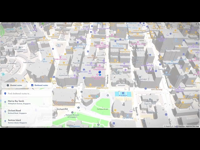
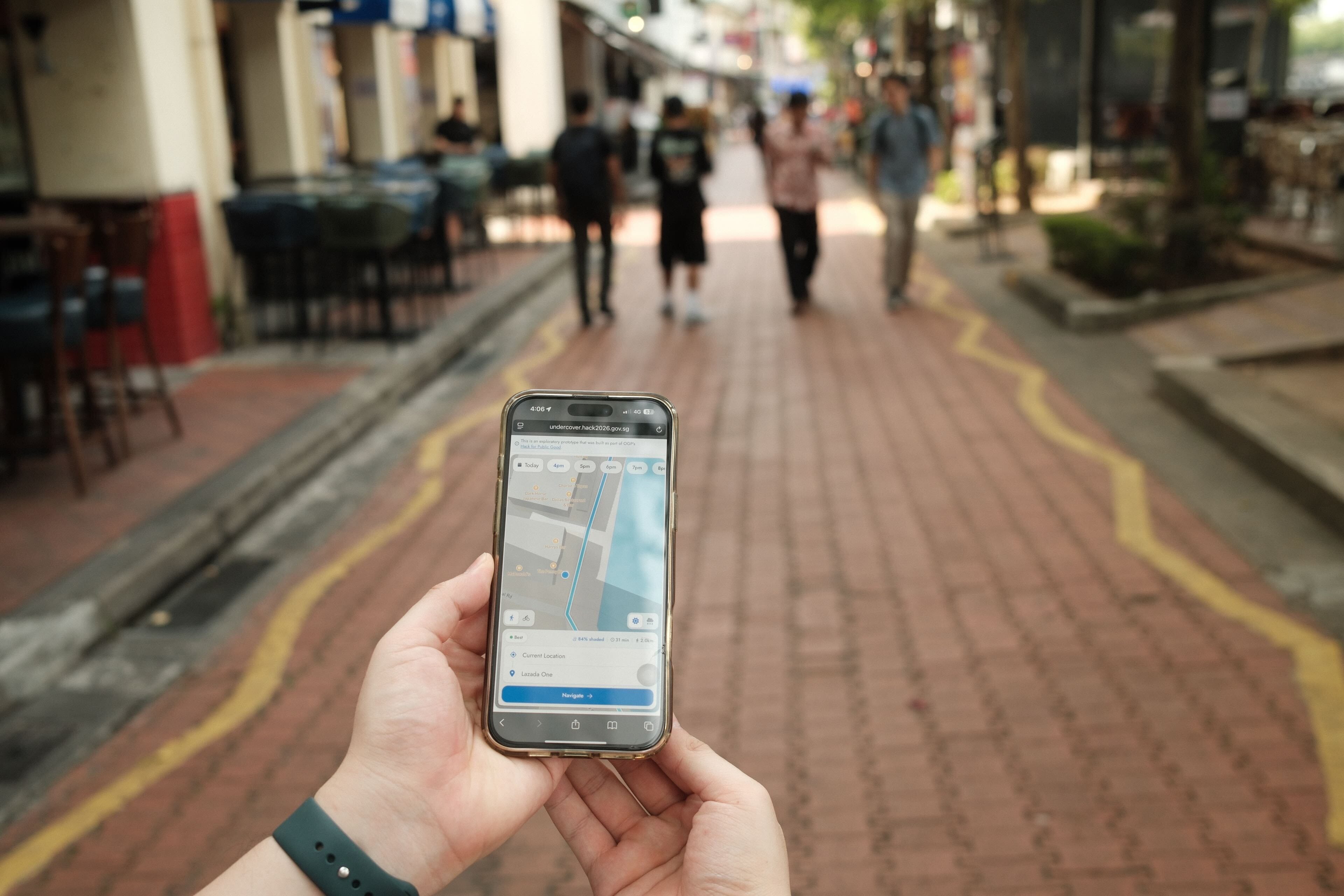
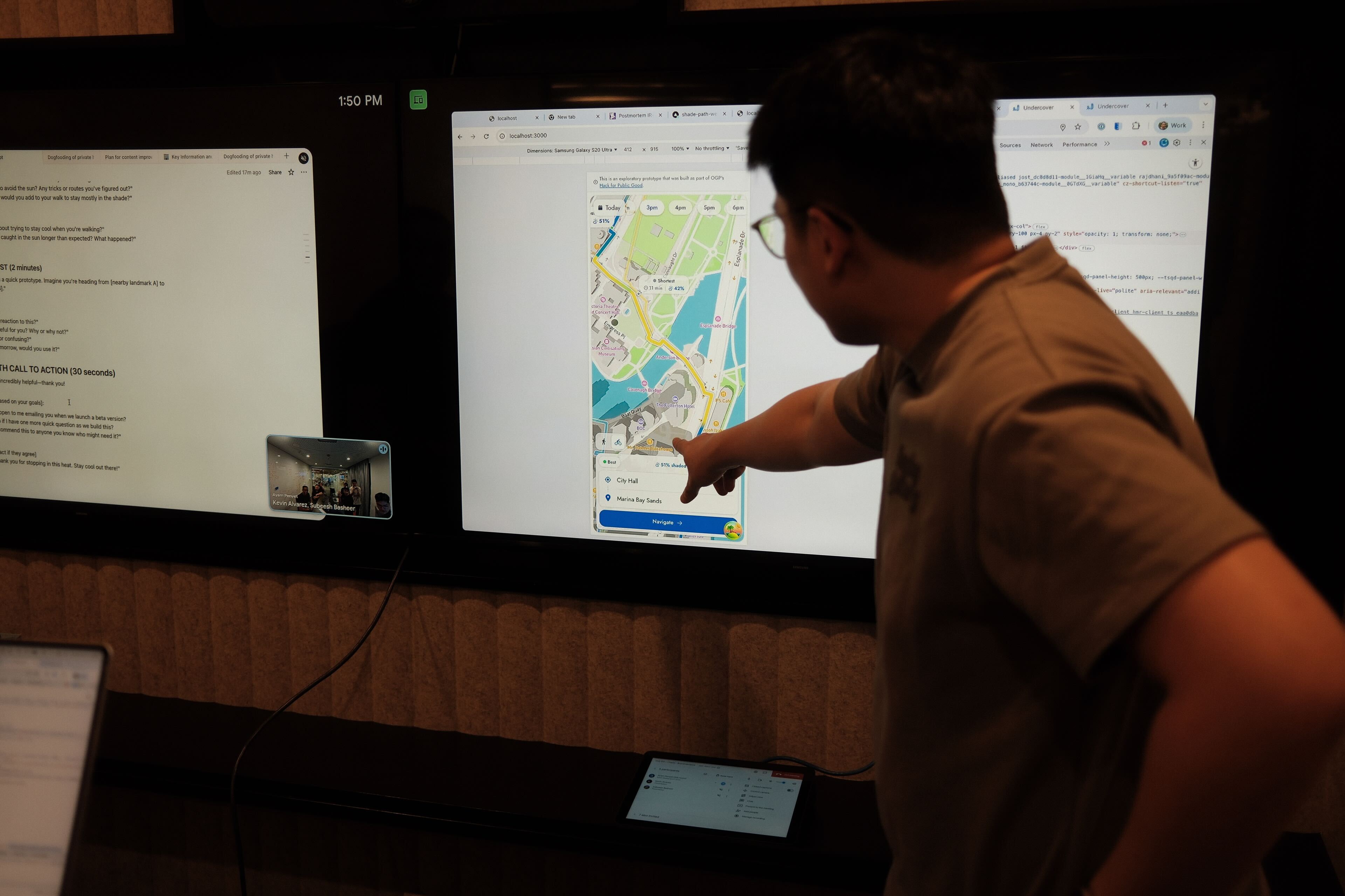
Find two points anywhere in Singapore and instantly see your options: the shortest path, the shadiest path, and a recommended balanced route. You'll see shade coverage percentages and all three routes visualised on a map.
Example routes from Undercover :

Lazada One to Bugis Junction at 5pm: The route via platforms like Google Map sends you down Waterloo Street before turning into Middle Road, whereas Undercover found a path through Waterloo Link onto Queen Street which made sure the route was 92% shaded.

Guoco Tower to Everton Park at 10am: Default routes takes you down Craig Road followed by Neil Road which are mostly exposed to the sun, whereas Undercover routes you through shade provided by neighbouring buildings and parks at a shade coverage of 84%.
Undercover generated thermally-driven routes help reduce heat stress by up to 32% compared to shortest-path routing
Just like that, instead of arriving drenched in sweat, Undercover gets you there, arriving cooler, feeling more human.
Under the hood
Existing routing engines like Google Maps and OneMap optimise for distance or travel time. They do not take into account shade, thermal comfort, or other environmental factors.
So we built Silverfox, a custom routing engine designed to apply arbitrary cost functions to pedestrian networks. Instead of minimising distance alone, it can minimise any weighted combination of factors: shade exposure today, rain shelter tomorrow, wheelchair accessibility in the future. The engine is objective-agnostic - shade routing is just the first application.
For each query, Silverfox returns three routes:
Shortest path: The conventional distance-minimised route
Most shaded path: Maximum shade coverage, regardless of distance
Recommended path: The sweet spot - a route that's meaningfully shadier without being unreasonably longer
Users see all three options and make their own call.
Data layer
Silverfox operates on a shade-annotated pedestrian network built from multiple sources: LTA's covered linkway data, OpenStreetMap building footprints with height attributes, and underground passage networks. Each edge in the network carries a shade score based on the type of coverage - full shelter from linkways and underground passes, or time-varying shadows from buildings.
Ray-traced shadow computation
Building shadows shift throughout the day - and throughout the year. Using ray tracing based on sun position, we compute shade coverage that's accurate to the hour you're walking. A path that's fully shaded at 9am might be exposed at noon. A route that works in December (when the sun is lower) might fail in June. Here’s a visualisation of how we compute ray-traced shadows on Jan 13 at 6pm before finding the most shaded route:
.png)
The routing cost for each path segment changes dynamically due to this. Silverfox takes all of this into account as it generated the recommended path for users, to ensure that they are out of the sun as far as possible.
Walking in comfort
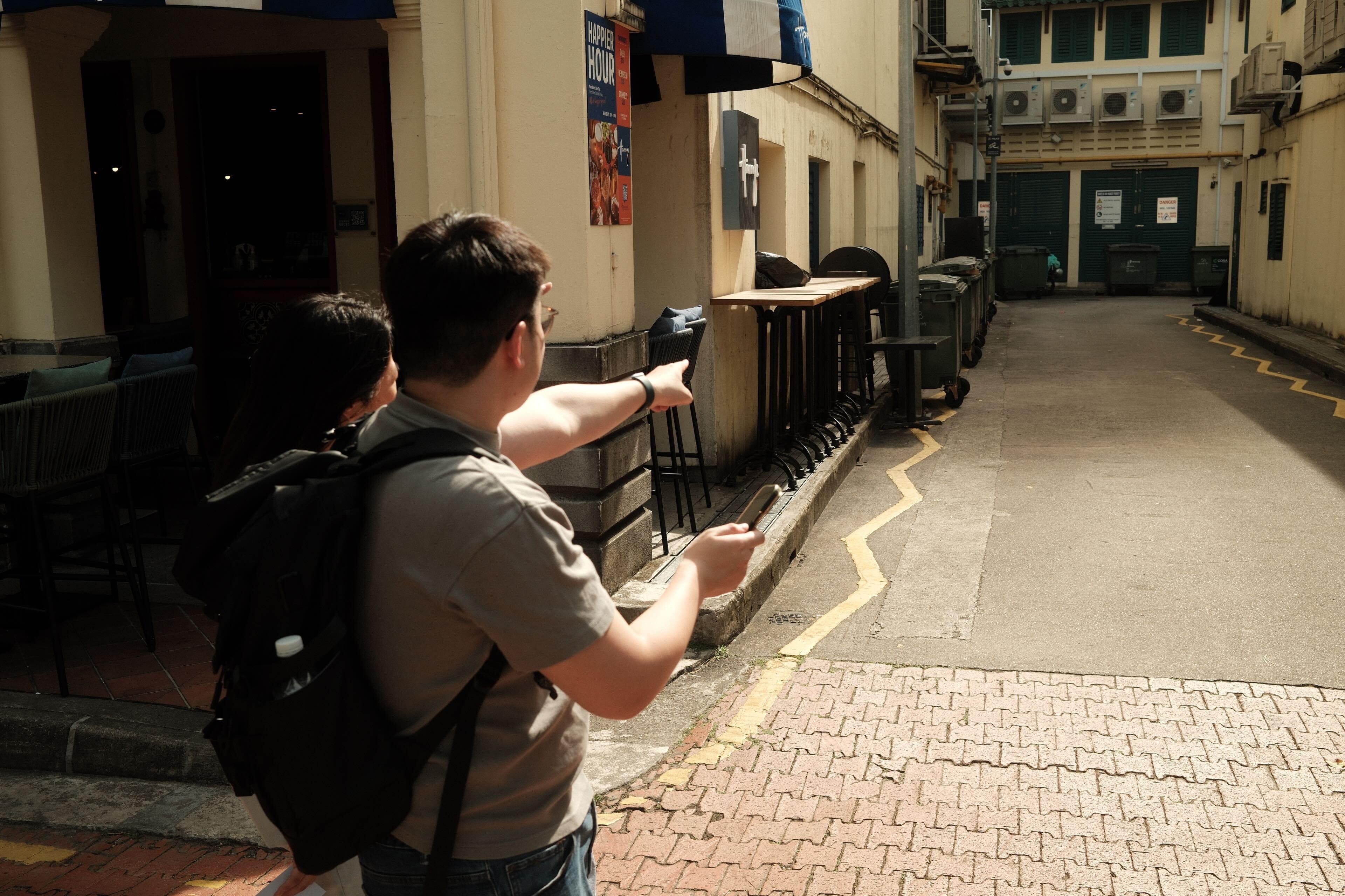
The team has tested Undercover with citizens and visitors across Singapore. Initial feedback has been encouraging.
I’ll definitely use this for any of my walking! Whether I’m going for lunch, grocery shopping or even commuting.— Working Professional in her 30s
I’ll use this when walking to a building from the MRT station so I can keep shaded!— Working Professional in his 40s
This is something I didn’t know I needed! I like to stay fair so this is important to me!— Student in her 20s
Wow, this is great! I’d see myself using this when going out with friends, or commuting to a place I’m unfamiliar with.— Student in his 20s
In the first week of trials, we saw more than 300 unique users try it out with 750+ routes calculated
with approximately 95% of users choosing the recommended path by Undercover - the sweet spot between shade and speed.
What's next
Beyond heat
Silverfox was designed to be objective-agnostic - shade is just the first cost function. The same engine has been retrofitted to optimise for rain shelter, finding routes through covered paths when it’s pouring outside. We intend the use the same engine for:
Accessibility: Prioritise stair-free routes, lifts, and gentle gradients
Crowds: Avoid bottleneck areas during peak hours

Adding a new routing objective means annotating the network with the relevant data and plugging in a new cost function. The routing infrastructure stays the same.
Integration opportunities
We're exploring integration with existing navigation platforms and government apps. The goal is to make shade-aware routing a standard option, not a separate tool. We're also in discussions with agencies about how Undercover's data layer could inform urban planning decisions and identifying gaps in the covered linkway network or prioritising shade infrastructure along high-traffic pedestrian routes.
The bigger map
Heat was our starting point, not our destination.
We asked: Is there a better way home? To start answering that, we mapped every building, overhead bridge, and underpass, and understood how it all changes with the time of day, the sun's position, and the weather.
There’s still much to be done: trees, real-time weather, accessibility data, and the dozen other factors that shape how people actually move through the city. Each layer we add gets us closer to the full map and closer to answering that simple question properly.
Undercover agents
The prototype was developed by the following team:

Kevin Alvarez | Andrew Tan | Nicholas Lim | Subeesh Basheer | Bryan Ong Wen Xi
Undercover is free for the public to use. Try it out, and navigate Singapore like a local at undercover.gov.sg.
If you're interested in collaborating, reach out to us at undercover@open.gov.sg!